
Aoraki / Mount Cook National Park

Mount Cook or Aoraki in Māori means “Cloud Piercer” with 3,724 m.a.s.l. is the highest mountain of New Zealand.
Aoraki/Mount Cook National Park is full of breathtaking alpine scenery, towering peaks, and vast glaciers. Spanning 722 square kilometres, the park is part of the Te Wāhipounamu UNESCO World Heritage Site. Dominated by Aoraki/Mount Cook, the highest mountain in New Zealand at 3,724 m.a.s.l., the park presents a stunning landscape of rugged mountains and icy expanses…
-
The park's prominent glaciers, including the Tasman, Hooker, and Mueller, descend from the Southern Alps, creating dramatic vistas and a unique glacial environment. However, due to climate change, these glaciers are rapidly retreating and thinning, significantly altering the park's ecosystem.
The park's ecosystems range from alpine meadows filled with vibrant wildflowers such as the Mount Cook buttercup, to rocky, snow-covered slopes where only the hardiest plants like alpine cushion plants can survive. The lower valleys are lined with subalpine scrub and beech forests, which provide habitats for a variety of native birds including the New Zealand falcon (kārearea) and the kea. The clear glacial lakes, such as Lake Pukaki and Lake Tekapo, offer stunning reflections of the surrounding mountains and are a vital part of the park's hydrology.
Aoraki, which means "Cloud Piercer" in Māori, holds significant cultural importance to the Ngāi Tahu iwi (tribe), who regard the mountain as an ancestor and a symbol of strength and endurance. The park is filled with Māori legend and tradition, with the landscape considered sacred, adding a deep cultural dimension to its natural wonder.
We stayed at White Horse Hill Campground just outside of Mount Cook Village for two weeks, working remotely and exploring the majority of the hiking trails around:
Sefton Bivvy is a small, colourful shelter situated at an elevation of around 1,660 m.a.s.l., nestled below Mount Sefton and Footstool. Hanging just above the shelter are impressive Tawaewae and Huddleston glaciers. We shared the shelter with a friendly New Zealand couple, who taught us that sometimes bringing a bottle of wine and making an exclusive dinner up in the mountains is worth it.
Muller Hut, located at 1,800 m.a.s.l. is probably one of the most popular huts in New Zealand and almost impossible to book during the season. And for a good reason - it provides 360-degree vistas of Aoraki/Mount Cook and the surrounding summits, with alpine landscapes reminiscent of the Himalayas. We camped close to a cliff about 200m from the hut, hiked up to Mount Ollivier for even better views and woke up the next day to a stunning sunrise.
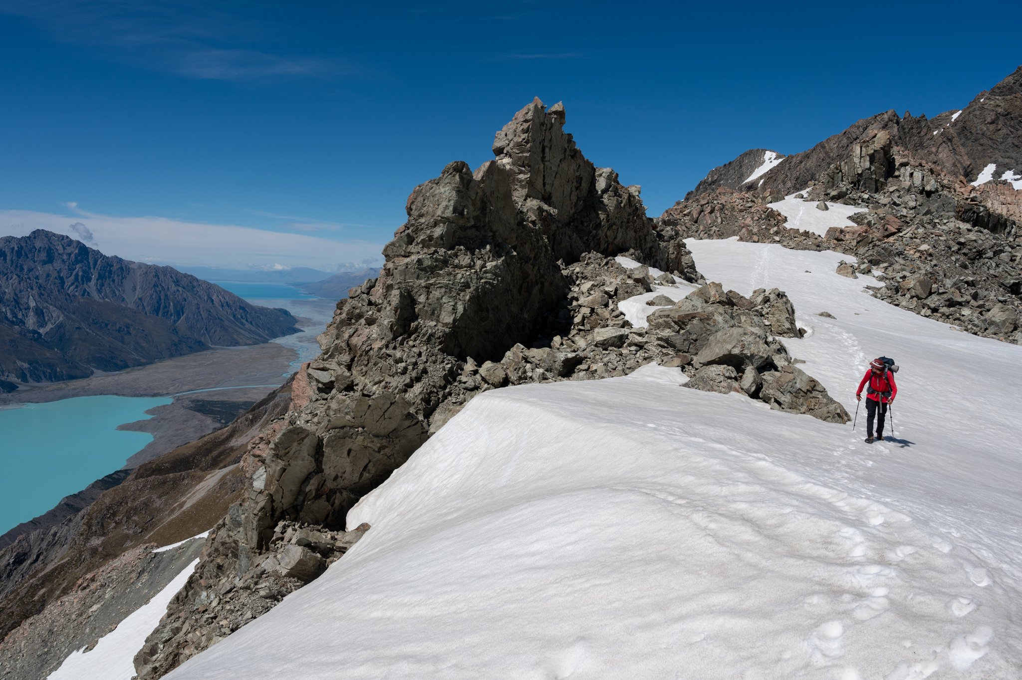
The Ball Pass is a challenging alpine crossing that traverses from the Hooker Valley into Tasman Valley, offering stunning views of the Tasman Glacier and some of the highest mountains of New Zealand, including Aoraki up close. A two to three-day journey requires some technical skills and experience in navigating steep, rocky terrain and snowfields.
Mount Wakefield at 2,058 m.a.s.l. is located just between the Hooker and Tasman Valley, at the beginning of the ridge leading to Mount Cook. We camped a bit below the summit.

Hooker river fed from the glacier with the same name and Aoraki / Mount Cook in the back.

There were still some wet snowfields on the way to Sefton Bivvy.

Sefton Bivvy and overhanging Tewaewae Glacier above it. The proximity of the ice was imprevice and.
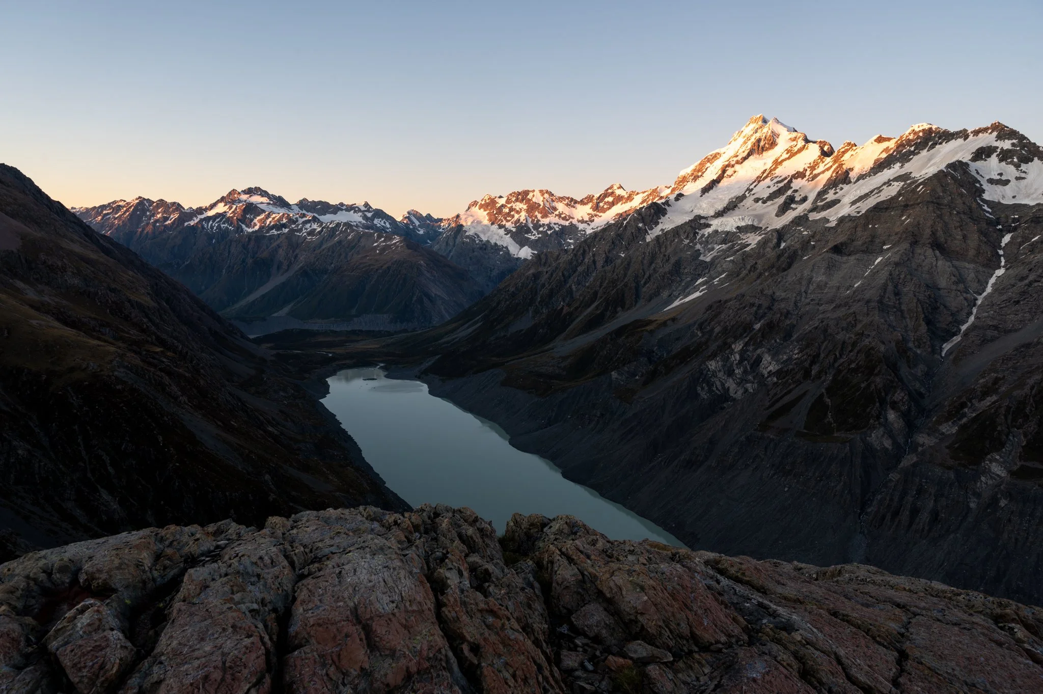
Our campground on the cliff close to Muller Hut offered us a stunning sunrise above the sea of clouds.

View from Mount Ollivier. Mueller Hut below with Mount Sefton above and Aoraki/Mount Cook at the back.

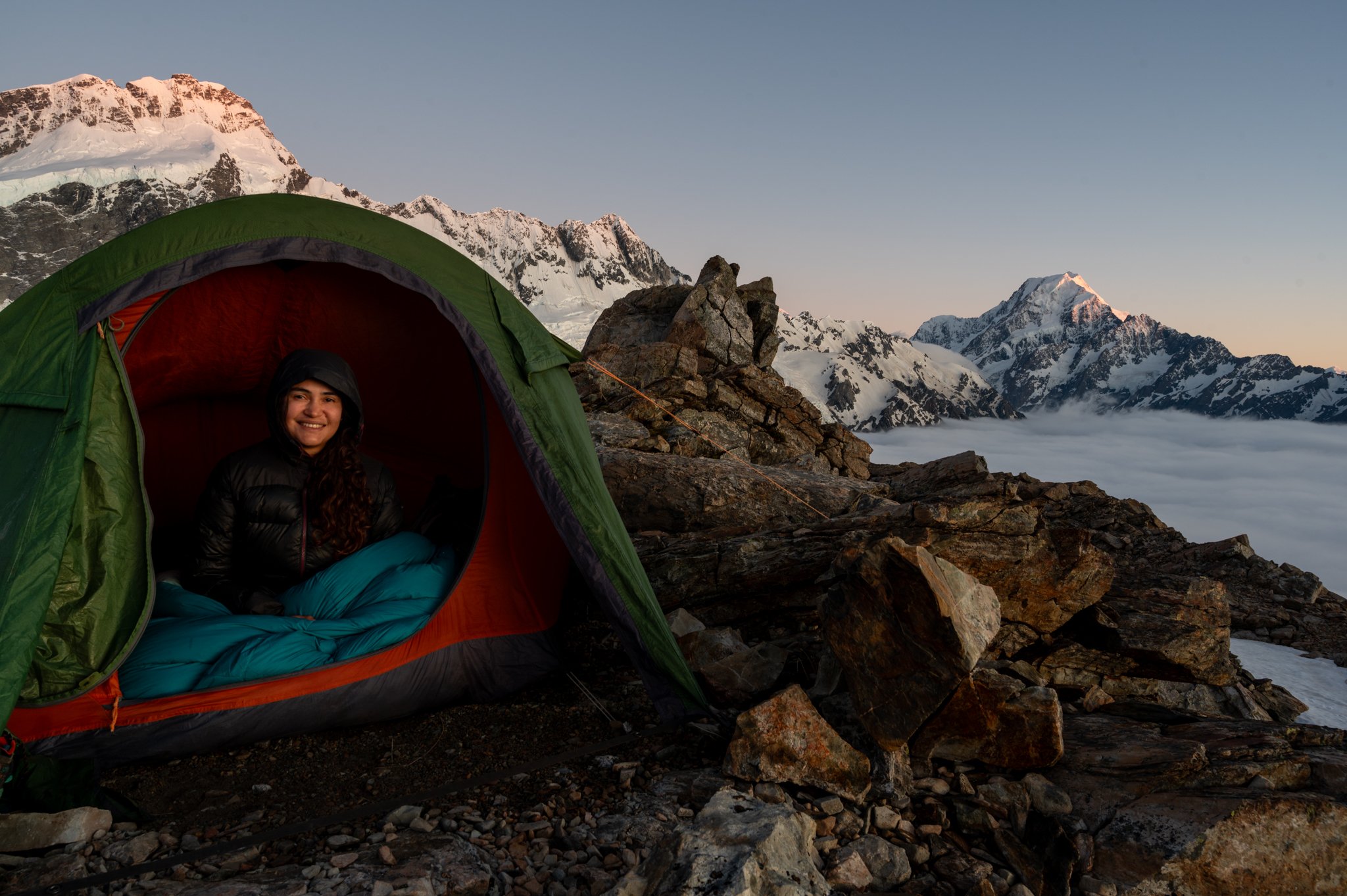
Starting the ascend from Hooker Valley to the Ball Pass. Snow gear was necessary.
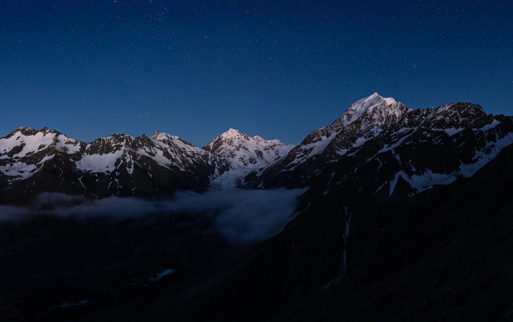
Aoraki/Mount Cook and the surrounding mountains illuminated by the moon, as seen from our camp on the way to Ball Pass.
Hooker Valley from the other side and Mount Sefton, illuminated by sunrise.

Kea came to visit us on our trip over the Ball Pass. Aoraki/Mount Cook behind.
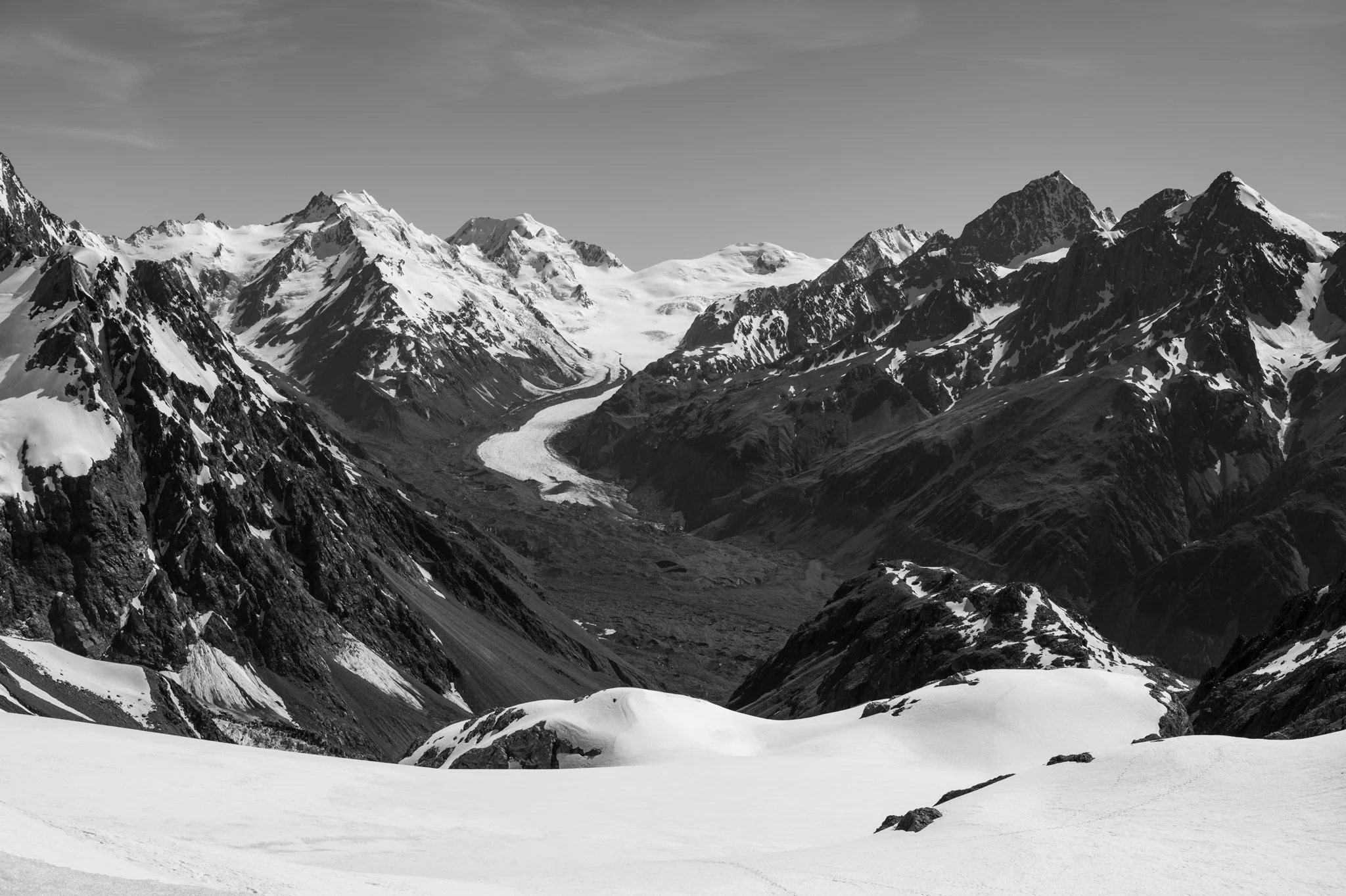
Extensive views from the Ball Pass over the Tasman Glacier and the surrounding mountains.
Descending into Tasman Valley.

Hooker and Tasman rivers feeding Lake Pūkaki. Photographed when descending from Mount Wakefield.