
Mount Aspiring National Park
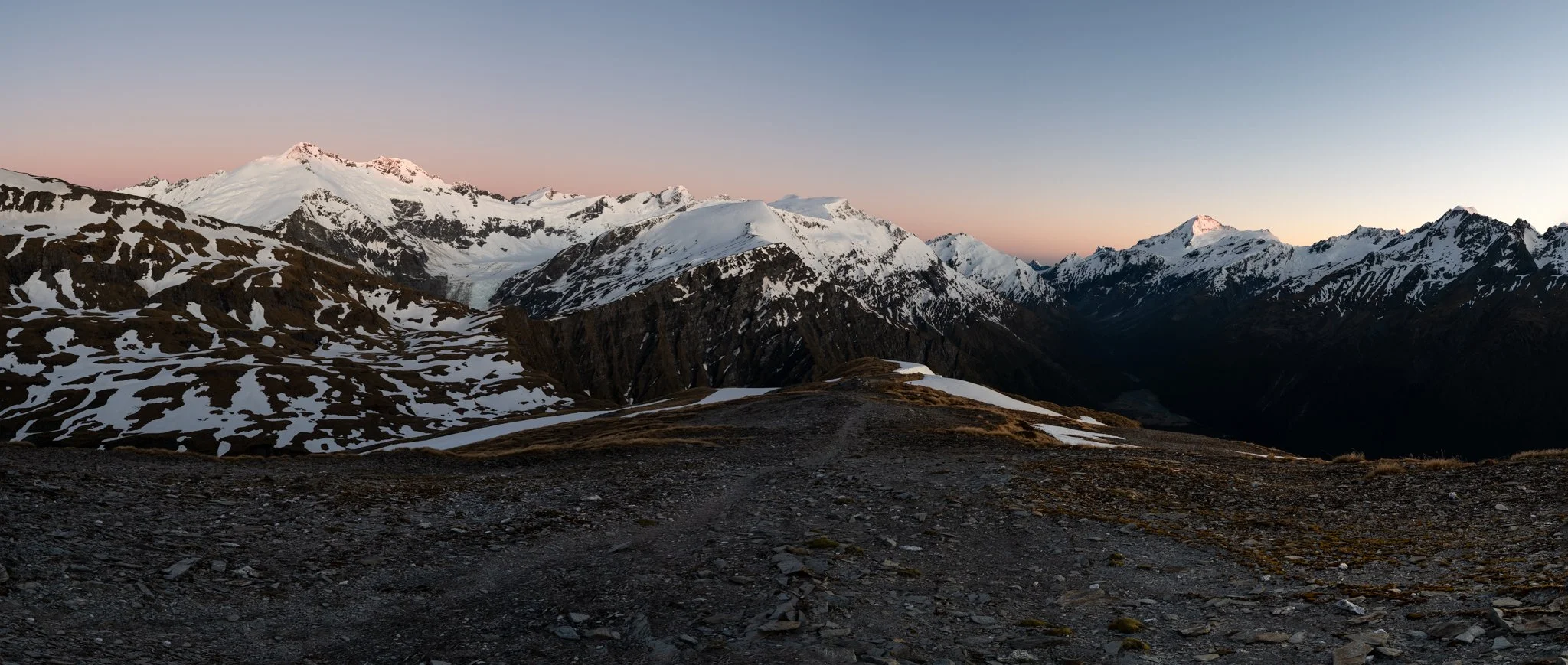
First light illuminates some of the highest mountains of Mount Aspiring National Park - Mount Aspiring/Tititea on the right and Mount Edward on the left.
Mount Aspiring National Park, showcases awe-inspiring alpine scenery, towering peaks, and extensive glaciers. Dominated by Mount Aspiring/Tititea, the highest peak outside the Aoraki/Mount Cook region at 3,033 meters, the park offers a breathtaking landscape of rugged mountains and vast ice fields…
-
The park's major glaciers, such as Bonar, Volta, and Therma, descend from the Southern Alps, creating dramatic and ever-changing vistas. However, climate change has led to significant retreat and thinning of these glaciers, altering the park's ecosystems.
The park's ecosystems range from lush alpine meadows brimming with vibrant wildflowers like the Mount Aspiring buttercup, to rocky, snow-covered ridges where only the hardiest alpine plants like cushion plants can thrive. The lower valleys are adorned with dense beech forests and subalpine scrub, providing habitats for a variety of native wildlife, including the New Zealand rock wren (pīwauwau) and the curious kea. Clear alpine lakes, such as Lake Crucible and Lake Sylvan, offer stunning reflections of the surrounding peaks and play a crucial role in the park's hydrology.
Mount Aspiring, known as Tititea to the Māori, meaning "Glistening Peak," holds deep cultural significance to the Ngāi Tahu iwi (tribe), who revere the mountain as a symbol of endurance and spiritual connection to the land.
Mount Aspiring National Park is likely the place on the South Island where we spent the most time. We entered the park from numerous locations, including the Matukituki River near Wānaka, Glenorchy, Hollyford River, Makarora, and more. We loved exploring:
A 3-day Rees-Dart Track that circulates Pikirakatahi / Mount Earnslaw massif, north of Glenorchy. Starting at Muddy Creek Car Park the trail follows the pastures next to Rees River before entering the beech forest that ends up near Shelter Rock Hut. The next day we leave the Rees Valley through the Rees-Dart Saddle, which offers immense views, toward a beautifully positioned Dart Hut. From here the trail gradually descends the Dart River towards the Daleys Flat Hut. From here, the Dart River braids before flowing into Lake Wakatipu. The trail ends at Chinaman's Bluff.
French Ridge Hut, a famous alpine hut in the heart of Mount Aspiring National Park. The hut, popular among mountaineers, is an entry point to the Bonar Glacier and the mountains around, such as Mount Avalanche, Popes Nose and Mount Tititea. The vibe of the hut is something else compared to the tramping huts, with everyone getting ready for their ascends, waking up well in the night to seize the best snow conditions possible. Several keas visit the hut early morning, scratching the roof to wake up anyone who might still be awake.
Camping at Cascade Creek and hiking up to Cascade Saddle for sunset offered breathtaking views of the surrounding landscape. To the north, the expansive vistas reveal the remote wilderness of the Mount Aspiring region, while to the south, the striking Rob Roy Glacier and its surrounding peaks come into view.
Brewster Glacier, located on the southwestern flanks of Mount Brewster. The volume of ice lost from Brewster Glacier over recent years has been substantial, equivalent to the basic drinking water requirements for all New Zealanders over three years. This stark statistic underscores the glacier's rapid retreat and the broader implications of global warming on New Zealand's glacial systems. We split the track into two days, camping next to Brewster Hut which has some of the best sunsets in New Zealand.
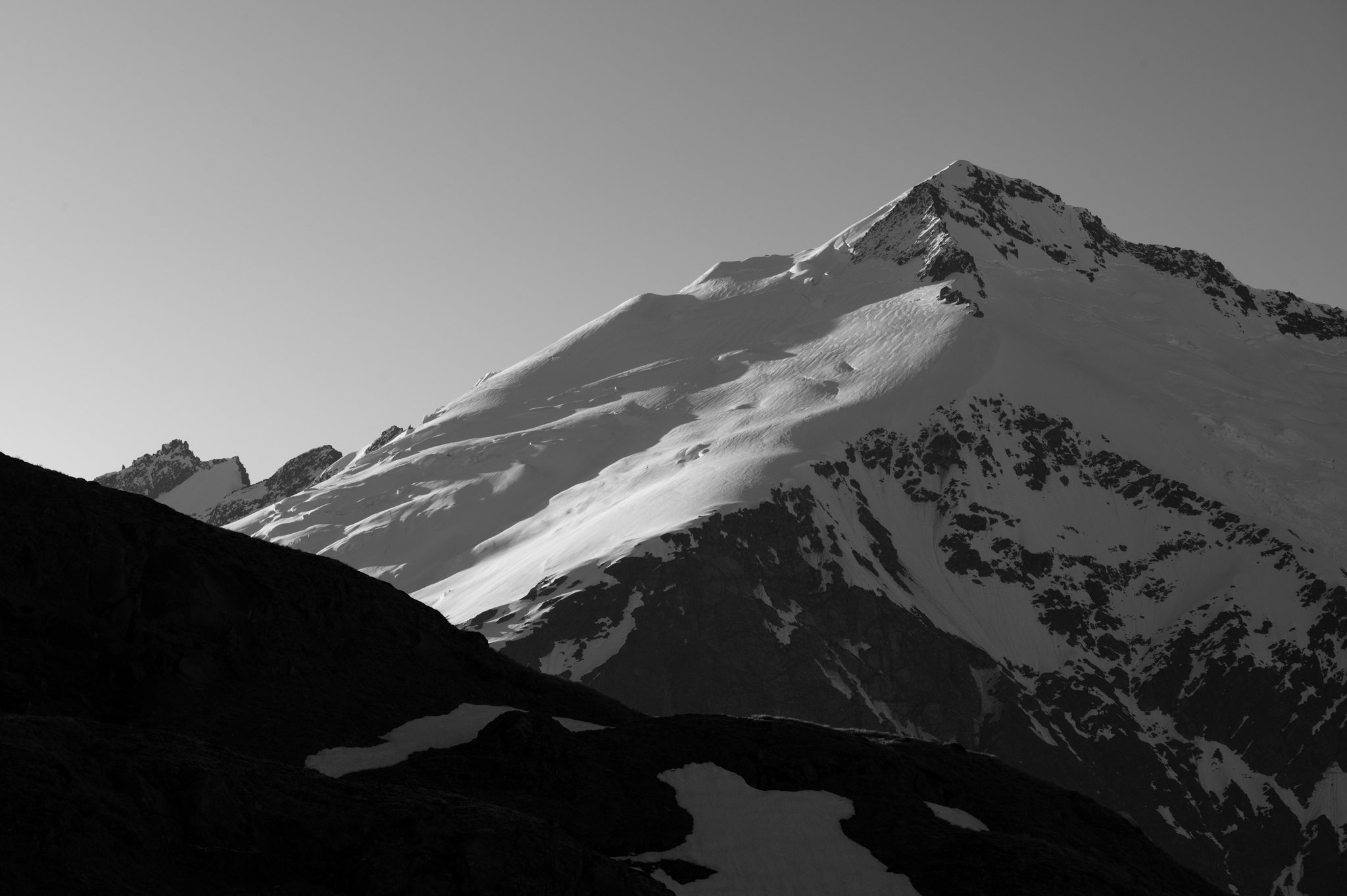
Pikirakatahi / Mount Earnslaw with 2830 m.a.s.l., is the second-highest mountain in Mount Aspiring National Park. It dominates the landscape north of Whakatipu-wai-māori (Lake Wakatipu). In December (too soon in the season) we tried to ascend its East Peak but were forced to retreat just 150 vertical meters below the summit due to solid ice build-up on the exposed gully. Nevertheless, it was a spectacular trip, camping above the Kea Basin below and spending a night in the Esquilant Bivvy.

I have shared a month in New Zealand with my parents, with whom I hiked several hiking trails of the South Island, including Rees-Dart Track in Mount Aspiring National Park. Thank you for always coming to see me all around the world!

Three days along the Rees-Dart track offered spectacular mountain scenery, forest and alpine vegetation, glacier-fed rivers and the Dart Glacier on the Rees-Dart Track.

Braided Dart River that flows into Lake Wakatipu.

My dad, Edvard, looking across the valley to Mount Edward (2,620m).

French Ridge Hut, is an entry point to the Bonar Glacier and the mountains around, such as Mount Avalanche, Popes Nose and Mount Tititea.

Cheeky kea coming for a morning visit to the French Ridge Hut.
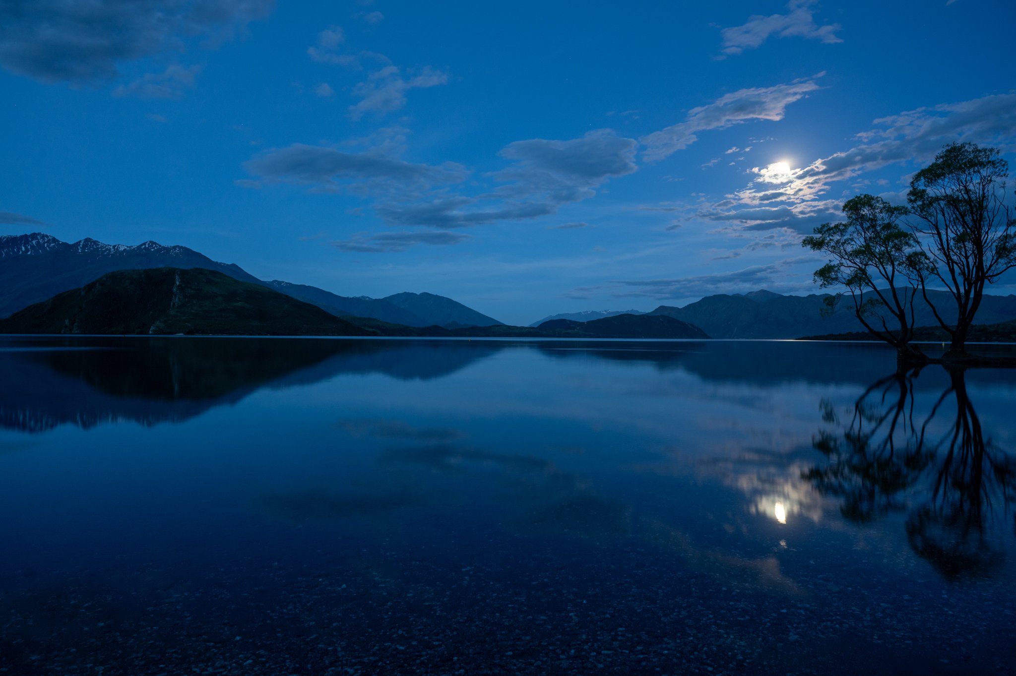
One of our favourite paid campsites was definitely Hampshire Holiday Park in Ghlendu Bay. Located just next to Lake Wānaka, it offered tranquillity during our hikes in Mount Aspiring National Park.
Sunset over Mount Edward from the other side - Cascade Saddle.

River going into Mount Aspiring, New Zealand's 23rd highest mountain. Māori call the peak Tititea, after a chief of the Waitaha tribe, who were the first people to settle the South Island.
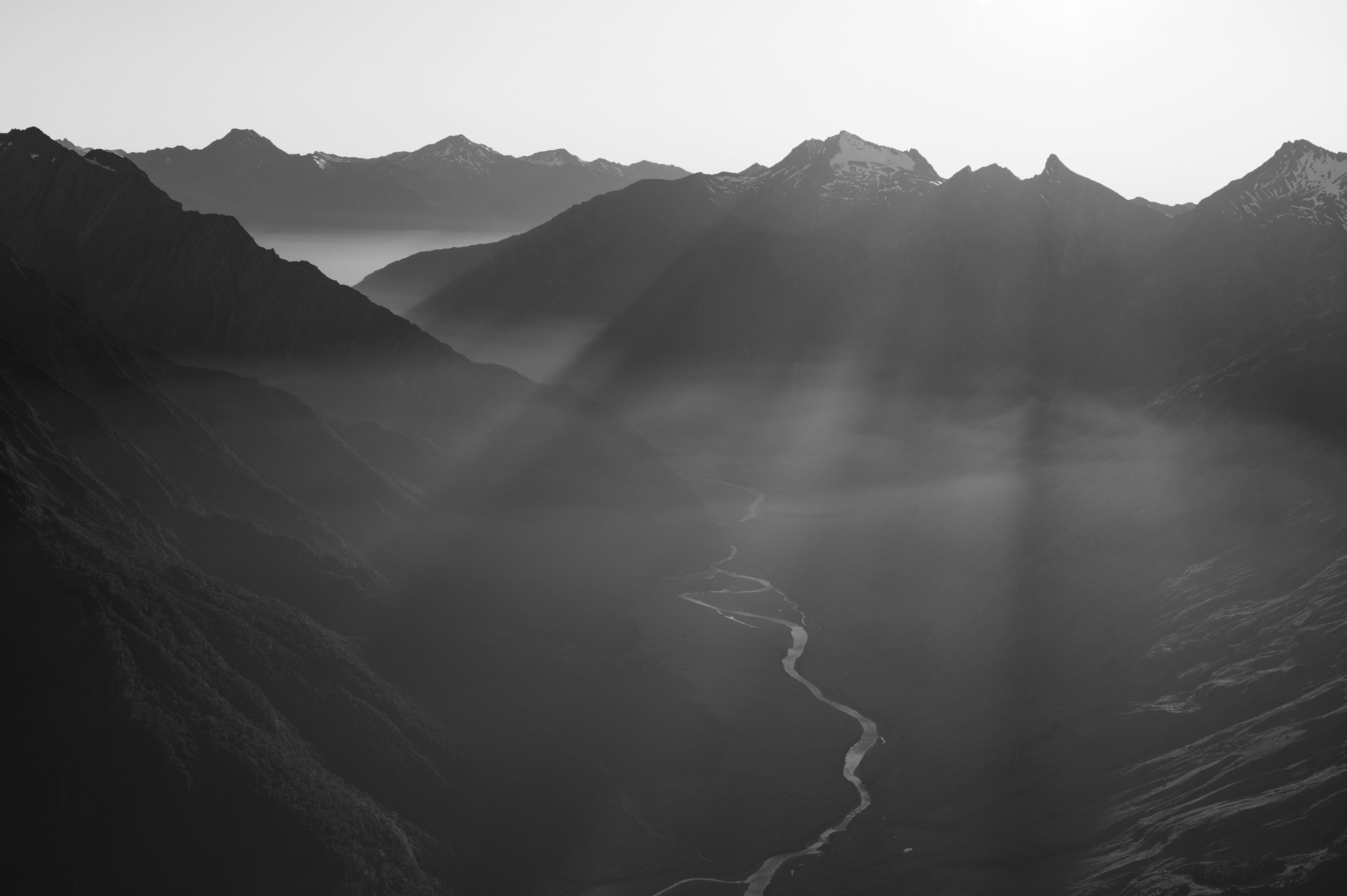
Mist and first sun rays over Matuki River and its valley, Aspiring National Park.

Brewster Hut has some of the best sunsets in New Zealand. There are a lot of places to camp around.

Brewster Glacier in Mount Aspiring National Park. Studies have shown that the volume lost from the Brewster Glacier in Mt Aspiring National Park due to climate change is about equal to the basic drinking water requirements for all New Zealanders for those three years.

Kea Basin is beautiful sub-alpine tussock basin beneath Mt Earnslaw/Pikirakatahi.

We stayed at Esquilant Hut on our way to Pikirakatahi / Mount Earnslaw, with 2830m the second-highest mountain in Mount Aspiring National Park.